![](/images/other/stat-length.png)
![Tour Mountainbike Le Hom - F.ThuryHarcourt.Gesnelay.J2/14 - Photo](https://media.geolcdn.com/t/1900/400/ext.pjpeg?maxdim=2&url=https%3A%2F%2Fstatic1.geolcdn.com%2Fsiteimages%2Fupload%2Ffiles%2F1524743154velo.jpg)
F.ThuryHarcourt.Gesnelay.J2/14
francois58
Benutzer
![Länge](/images/other/stat-length.png)
Länge
85 km
![Maximale Höhe](https://static1.geolcdn.com/siteimages/upload/files/1508320355ic_sort_altitude_max_24dp.png)
Maximale Höhe
275 m
![Positive Höhendifferenz](https://static1.geolcdn.com/siteimages/upload/files/1508320355ic_sort_den_pos_24dp.png)
Positive Höhendifferenz
1223 m
![Km-Effort](/images/other/stat-length.png)
Km-Effort
101 km
![Min. Höhe](https://static1.geolcdn.com/siteimages/upload/files/1508320355ic_sort_altitude_min_24dp.png)
Min. Höhe
23 m
![Negative Höhendifferenz](https://static1.geolcdn.com/siteimages/upload/files/1508320355ic_sort_den_neg_24dp.png)
Negative Höhendifferenz
1155 m
![Boucle](https://static1.geolcdn.com/siteimages/upload/files/16400158638029165_repeat_loop_refresh_sync_direction_icon.png)
Boucle
Nein
Erstellungsdatum :
2019-01-15 12:27:11.695
Letzte Änderung :
2019-01-15 12:27:11.695
![Mountainbike](https://static1.geolcdn.com/sitytour/trail-icons/202.png)
5m
Schwierigkeit : Einfach
![Scannen Sie diesen QR-Code, um die Tour in der SityTrail-Anwendung zu öffnen](https://capi.geolives.com/qq0zvz2zws4bq2lad0pu/sitytour/trails/997565/qr.png?size=200)
Kostenlosegpshiking-Anwendung
Über SityTrail
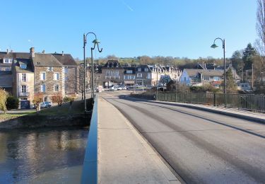
Tour Mountainbike von 85 km verfügbar auf Normandie, Calvados, Le Hom. Diese Tour wird von francois58 vorgeschlagen.
Beschreibung
Jour 2/14 d'une rando Cabourg-Bordeaux. Sur l'ensemble du parcours, la majorité du tracé est en macadam avec plusieurs tronçons VTC et 4-5 passages VTT limités en longueur.
NB. Largement inspiré de la "Vélofrancette", de la "Vélodyssée" et du "Canal des Deux Mers".
Ort
Land:
France
Region :
Normandie
Abteilung/Provinz :
Calvados
Kommune :
Le Hom
Standort:
Thury-Harcourt
Gehen Sie:(Dec)
Gehen Sie:(UTM)
684577 ; 5429067 (30U) N.
Kommentare
Touren in der Umgebung
![Tour Zu Fuß Le Hom - La Vallée de l'Orne - Photo](https://media.geolcdn.com/t/375/260/ext.jpg?maxdim=2&url=https%3A%2F%2Fmedia.geolcdn.com%2Ff%2F8002bbe4-56e1-4329-945e-78c51bb73184.jpeg)
![Zu Fuß Zu Fuß](https://static1.geolcdn.com/sitytour/trail-icons/100.png)
La Vallée de l'Orne
Zu Fuß
Medium
Le Hom,
Normandie,
Calvados,
France
![](/images/other/stat-length.png)
17,1 km | 23 km-effort
5h 10min
![](https://static1.geolcdn.com/siteimages/upload/files/16400158638029165_repeat_loop_refresh_sync_direction_icon.png)
Ja
![Tour Zu Fuß Culey-le-Patry - Le Mouin du Fay - Photo](https://media.geolcdn.com/t/375/260/ext.jpg?maxdim=2&url=https%3A%2F%2Fmedia.geolcdn.com%2Ff%2Feb1521b3-cf98-4c55-9410-8de821da7add.jpeg)
![Zu Fuß Zu Fuß](https://static1.geolcdn.com/sitytour/trail-icons/100.png)
Le Mouin du Fay
Zu Fuß
Einfach
Culey-le-Patry,
Normandie,
Calvados,
France
![](/images/other/stat-length.png)
4,8 km | 6,7 km-effort
1h 31min
![](https://static1.geolcdn.com/siteimages/upload/files/16400158638029165_repeat_loop_refresh_sync_direction_icon.png)
Nein
![Tour Zu Fuß Espins - D'Espins au Moulin du traspy - Photo](https://media.geolcdn.com/t/375/260/ext.jpg?maxdim=2&url=https%3A%2F%2Fmedia.geolcdn.com%2Ff%2F6b452037-ce7a-42f3-8e30-05ba5c0eb969.jpeg)
![Zu Fuß Zu Fuß](https://static1.geolcdn.com/sitytour/trail-icons/100.png)
D'Espins au Moulin du traspy
Zu Fuß
Einfach
Espins,
Normandie,
Calvados,
France
![](/images/other/stat-length.png)
6,9 km | 9 km-effort
2h 3min
![](https://static1.geolcdn.com/siteimages/upload/files/16400158638029165_repeat_loop_refresh_sync_direction_icon.png)
Ja
![Tour Zu Fuß Esson - La Chapelle Bonne Nouvelle - Photo](https://media.geolcdn.com/t/375/260/ext.jpg?maxdim=2&url=https%3A%2F%2Fmedia.geolcdn.com%2Ff%2F82717480-a9c2-41c9-93af-e42d631dbd18.jpeg)
![Zu Fuß Zu Fuß](https://static1.geolcdn.com/sitytour/trail-icons/100.png)
La Chapelle Bonne Nouvelle
Zu Fuß
Einfach
Esson,
Normandie,
Calvados,
France
![](/images/other/stat-length.png)
9,5 km | 13,3 km-effort
3h 1min
![](https://static1.geolcdn.com/siteimages/upload/files/16400158638029165_repeat_loop_refresh_sync_direction_icon.png)
Ja
![Tour Zu Fuß Esson - GRP Tour de la Suisse Normande - Photo](https://media.geolcdn.com/t/375/260/ext.jpg?maxdim=2&url=https%3A%2F%2Fmedia.geolcdn.com%2Ff%2F96471841-70b2-445a-bcf9-e6471b393594.jpeg)
![Zu Fuß Zu Fuß](https://static1.geolcdn.com/sitytour/trail-icons/100.png)
GRP Tour de la Suisse Normande
Zu Fuß
Schwierig
Esson,
Normandie,
Calvados,
France
![](/images/other/stat-length.png)
25 km | 35 km-effort
7h 58min
![](https://static1.geolcdn.com/siteimages/upload/files/16400158638029165_repeat_loop_refresh_sync_direction_icon.png)
Nein
![Tour Mountainbike Saint-Rémy - VTT Suisse Normande N°10 - St Rémy sur Orne - Photo](https://media.geolcdn.com/t/375/260/ext.jpg?maxdim=2&url=https%3A%2F%2Fservices.sitytrail.com%2FGeolivesWS%2FDownloadMedia.ashx%3FTrailID%3D173106%26Media%3D14655_3.jpg)
![Mountainbike Mountainbike](https://static1.geolcdn.com/sitytour/trail-icons/202.png)
VTT Suisse Normande N°10 - St Rémy sur Orne
Mountainbike
Einfach
Saint-Rémy,
Normandie,
Calvados,
France
![](/images/other/stat-length.png)
15,8 km | 20 km-effort
1h 30min
![](https://static1.geolcdn.com/siteimages/upload/files/16400158638029165_repeat_loop_refresh_sync_direction_icon.png)
Ja
![Tour Wandern Le Hom - le pont Hom (boucle) - Photo](https://media.geolcdn.com/t/375/260/ext.jpg?maxdim=2&url=https%3A%2F%2Fstatic1.geolcdn.com%2Fsiteimages%2Fupload%2Ffiles%2F1553511878bg_sport_marche.png)
![Wandern Wandern](https://static1.geolcdn.com/sitytour/trail-icons/101.png)
le pont Hom (boucle)
Wandern
Medium
(1)
Le Hom,
Normandie,
Calvados,
France
![](/images/other/stat-length.png)
12,1 km | 16 km-effort
2h 45min
![](https://static1.geolcdn.com/siteimages/upload/files/16400158638029165_repeat_loop_refresh_sync_direction_icon.png)
Ja
![Tour Wandern Ouffières - ouffi - Photo](https://media.geolcdn.com/t/375/260/ext.jpg?maxdim=2&url=https%3A%2F%2Fmedia.geolcdn.com%2Ff%2F11703828-2ceb-45cd-a7e2-4a32994ac9c5.jpg)
![Wandern Wandern](https://static1.geolcdn.com/sitytour/trail-icons/101.png)
![Tour Zu Fuß Saint-Rémy - La Mousse - Photo](https://media.geolcdn.com/t/375/260/ext.jpg?maxdim=2&url=https%3A%2F%2Fmedia.geolcdn.com%2Ff%2F82717480-a9c2-41c9-93af-e42d631dbd18.jpeg)
![Zu Fuß Zu Fuß](https://static1.geolcdn.com/sitytour/trail-icons/100.png)
La Mousse
Zu Fuß
Einfach
Saint-Rémy,
Normandie,
Calvados,
France
![](/images/other/stat-length.png)
7,3 km | 9,6 km-effort
2h 10min
![](https://static1.geolcdn.com/siteimages/upload/files/16400158638029165_repeat_loop_refresh_sync_direction_icon.png)
Nein